2007 Excavations
Silbury Hill Latest News
SILBURY HILL UPDATE 1st June 2006
As you may have seen in the Press English Heritage recently announced
the appointment of engineering contractor Skanska to take forward the next
stage of repair work to Silbury Hill. Skanska will now begin working with
English Heritage to draw up detailed repair plans for the Hill.
The repairs will tackle the damage caused to the Hill after a collapse
of the infilling to a shaft at the top of the Hill in 2000. The brief for
engineers was prepared by English Heritage and a team of expert advisors,
and its aim is to find the best method for returning the Hill to its original
state and preserving its long term stability. As well as permanently infilling
the collapse to the head of the shaft, the works will involve the thorough
backfilling of tunnels at the base of the hill, and repair the slumping on
the sides of the Hill. The chosen method for backfilling is to re-enter the
Hill through the 1968 Atkinson tunnel to its centre.
Skanska won the work after presenting a detailed submission covering practical
design and construction techniques, risk management plans and an approach
integrating the archaeological and construction elements of the project.
The firm proposes using the Atkinson's original supports and additional temporary
props to keep disturbance of the Hill's archaeology to an absolute minimum.
Archaeologists will be working alongside the contactors to make a record
of the internal structure of the Hill and take samples to recover palaeoenvironmental
evidence and material for radiocarbon dating.
Skanska has worked with English Heritage on Silbury Hill in the past,
contributing to the specialist stability survey work carried out on the
Hill since 2000. The firm was selected for this phase of the work because
the project board felt their submission best demonstrated how the brief
could be safely met with the least risk of disruption to the Hill's archaeology
and within a realistic timeframe and budget.
The development of detailed repair plans is now expected to take six months.
Depending on the outcome of this development work, English Heritage hopes
to commission the full repairs by Skanska and announce the start of repair
work in Spring 2007. The repair project will be accompanied by a programme
of archaeological investigation, recording and sampling.
We are working on the outreach and publicity programme. The relevant pages
on the EH website will soon be up-dated which you will be able to access
for future information.
Yours sincerely
(Signed)
Dr Robert H Bewley
Planning & Development Regional Director SW
English Heritage
Bid to save Silbury Hill could cost £600,000
Thursday 1st Dec 2005.
THE collapse of infill at Silbury Hill has happened before and will happen
again unless urgent action is taken to stabilise it, a meeting in Devizes
heard on Saturday.
English Heritage had called the ticket-only meeting to discuss its preferred
option for the future of Silbury Hill, the most ancient man-made structure
in northern Europe.
It wants to enter the tunnel dug by a team of archaeologists in 1968 and
back-fill it with chalk, also filling in the voids created during the various
excavations of the mound since the 1776 tomb-raiding exploits of the Duke
of Northumberland.
Amanda Chadburn, one of the English Heritage team who has been investigating
the current state of the hill, said the appearance of the hole at the top
of the mound in May 2000 had come as a shock to archaeologists.
There had been a further collapse in December 2000 after which the hole
was given a metal cap supported by scaffolding. The hole is now temporarily
filled with enormous expanded polystyrene blocks.
It had been well known that the Duke of Northumberland, searching for the
legendary golden statue of King Zil reputed to be buried in the mound, had
employed miners to dig a shaft straight down through the centre of the hill
and had refilled it with branches topped with a chalk plug.
The situation was made worse by a subsequent tunnel dug into the side of
the hill by workmen hired by Dean Merewether in 1849.
But during her investigations through the archives of various museums in
the county, Ms Chadburn had discovered that the collapse of the central shaft
had happened before.
She showed an aerial photograph taken in 1925 clearly showing a hole at
the top of Silbury Hill, similar to the one that opened up in 2000.
She had also found letters referring to this hole that was eventually filled
in by the Ministry of Works in 1936.
Archaeologist Fachtna McAvoy said boreholes were driven into the hill by
English Heritage to carry out a seismic survey of its interior.
Cameras were lowered down these holes and archaeologists were appalled
to see huge voids that had appeared in the 1968 Atkinson tunnel that was
supposed to have been properly backfilled.
Bob Bewley, regional director of English Heritage, said it was important
to enter the tunnels and make sure that all voids were properly filled to
prevent any further collapses within the ancient monument.
But Nigel Swift, for the protest group Heritage Action, urged English Heritage
to think again.
He told the meeting: "Re-tunnelling will destroy a lot of archaeology so
we would have to have a lot of confidence that English Heritage knows what
it is doing. We see no confidence in it."
He said English Heritage's own figures showed the damage caused by tunnelling
would amount to 166 cubic metres and a better option would be grouting the
voids from outside the hill by pumping in filler material.
Professor Chandler from Imperial College, London, said the hill was in
no immediate danger.
He said: "The hill looks not too different from the way it looked when
it was completed. Rabbits and badgers are doing more damage than anything
else done to it over the centuries."
Mr Bewley said that invitations to tender were going out to prospective
contractors over the next few weeks and the work was unlikely to be complete
before 2007.
The cost has not been finalised but it is thought to be in the region of
£600,000.
August 2005
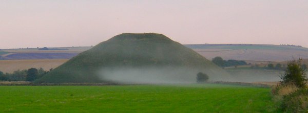
EXPERTS have come up with a plan to save ancient landmark Silbury Hill
from collapsing in on itself
but they need up to £600,000 to carry it out.
English Heritage has reached a decision on which option to take to
stabilise the ancient monument,
the largest prehistoric man-made construction in Europe, and guarantee
its continued existence for centuries to come.
It has chosen to re-enter Silbury Hill through the tunnel dug to
its centre in 1968,
the subject of a BBC film made by Magnus Magnusson at the time.
The existing material that has been used to backfill the various
excavations that have taken place over the last 200 years
or so will be removed and replaced with chalk to the same density as
the surrounding mound material.
The temporary capping at the top of the shaft dug into the hill in
the 18th century, which is composed of expanded polystyrene,
will be removed and it, too, replaced with chalk.
Bob Bewley, south west regional director for English Heritage, said:
"The tunnels have never presented the major problem.
Most of the subsidence is as a result of the shaft that was dug by
the Duke of Northumberland's men in
1776 straight down through the centre of the monument in the search
for gold.
"They found no gold at the base but it has left us with major headaches
as it has never been satisfactorily filled in and is the
cause of all the major subsidence that has threatened Silbury Hill."
Mr Bewley and his colleagues are confident that recent work to stabilise
the monument will keep it safe in the short term
while arrangements are made to undertake the massive effort to complete
the repairs.
It has already been five years since a massive hole opened up at
the top of Silbury Hill,
which was exclusively reported by the Gazette at the time.
But Mr Bewley explained that rescuing a 4,700-year-old construction
from dereliction is no short-term matter.
He said: "We have not taken the quick and easy fix but have tried
to understand what is happening inside the hill,
which is why is has taken so long to come up with our decision.
"When we are finished the hill will hopefully not require any further
attentions for hundreds of years,
although we will be monitoring it regularly."
A project board meeting is due to be held in October when a decision
will be taken to put the work out to tender.
Mr Bewley said: "We hope to find the right contractor in this financial
year and the work will be started in either the
next financial year or the following one.
"The biggest thing will be finding the money for the work. We reckon
it is going to cost in the region of £500,000 or £600,000
and we are going to have to find that money from somewhere.
"Some of that may come from commercial sponsorship. Large companies
and other organisations may be pleased to be
involved with this kind of project.
"It is a World Heritage Site and will attract publicity from all
over the world."
Update on the future of Silbury Hill
from http://www.english-heritage.org.uk/server/show/nav.8820
English Heritage has announced the latest stage in the process to
repair and preserve Silbury Hill,
the largest Neolithic construction of its type in Europe, and part
of the ancient landscape of Avebury,
a World Heritage Site. Since the collapse in 2000 of infilling
to a shaft at the top of the Hill,
English Heritage along with a team of expert external advisors, has
carried out extensive investigations into the
condition of the Hill and research as to the best way forward to
preserve its long term stability.
This work outlined a number of options for the future of the Hill,
one of which has now been selected by
English Heritage for further exploration and feasibility studies.
English Heritage consulted with a wide group of interested parties
before the decision was taken, and presented three
main options for discussion at a seminar for local and national archaeology
experts in
September 2004. The option chosen is to re-enter Silbury Hill via
the tunnel dug to its centre in 1968, and then remove
existing collapse and inadequate backfill in the tunnel, before properly
backfilling it. The tunnel and other voids within
the Hill would be filled with chalk to the same density as the surrounding
mound material. The work of backfilling
would take place backwards from the centre of the Hill, and enable
contractors to remove any temporary supports
left after previous excavations. The work would be accompanied by
an archaeological investigation programme which
would fully record all the parts of the Hill which are exposed
again and enhance our knowledge of its construction.
Following this work, the temporary capping to the top of the
shaft at the summit of the Hill would be replaced with chalk,
and a monitoring programme put in place to assess any settlement
of the of the Hill in the future. The benefit of this way
forward is that it will return the Hill to as near its original state
as can be practicably achieved. It will prevent further damage
to the Hill from upward migration of existing cavities. It will preserve
the long term stability of the Hill, whilst minimising
further damage to its unique archaeology. In its work to date on
the Hill, English Heritage surveys have confirmed
that the overall structure of the mound is stable, although there
are localised pockets of instability arising from the
presence of the shaft dug in 1776 and the inadequate backfilling
of the tunnels to the centre of the Hill, which were
dug in 1849 and 1968/9. What happens next? English Heritage is drawing
up a detailed brief for contractors, who
will be asked to demonstrate how they would execute the proposed
option whilst fulfilling the overall objectives of
the project. English Heritage will assess their submissions
before making a final decision on whether to go
ahead with the work.
At the same time, English Heritage will be looking into funding options
for the project.
May 2003
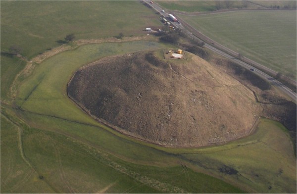
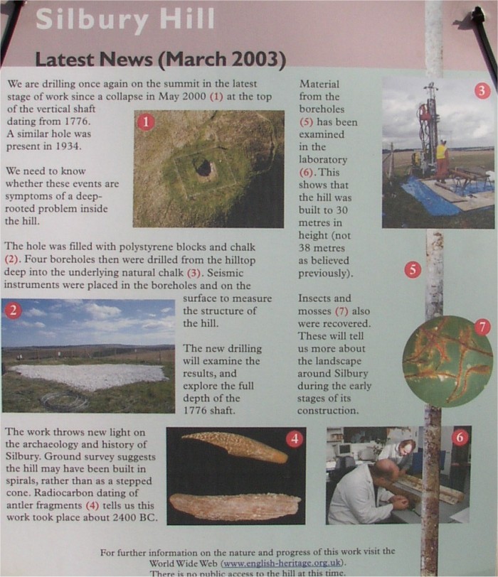
3 years after the initial collapse the
hole is still not fixed properly!
25th February 2003
English Heritage is now planning to
investigate the area of the previously collapsed shaft. As part of this assessment
EH intend to test the
consistency of the backfilling in the
lower part of the shaft by drilling a borehole through it from the top.
Another borehole will be drilled nearby
as a control. The information gathered
will help EH design long-term remedial work.
The work is due to start during the first
week of March 2003 and to be completed on site on 26 March 2003.
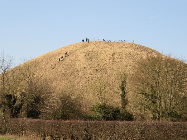
More morons climbing the hill to view the
No War banner.
(EH removed the banner on 25th feb)
November 2002
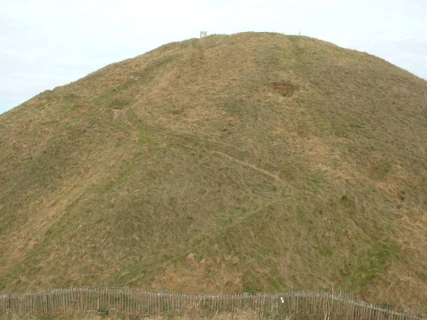
Hollows appear near the surface of the hill
(Compare to April photo below)
Silbury Picnic.
2nd Anniversary gathering.
You can now watch the documentary
'The Hill with the Hole'
Here
Video
Cementaton skanska return for further scanning.
April 2002
MORE SILBURY HILL SECRETS REVEALED
Surveys on Silbury Hill, the prehistoric
monument near Avebury in Wiltshire, where the partial collapse of an 18th
century mining shaft led
to a hole appearing in 2000 at its summit,
have revealed that the hill's structure appears to be stable. But more work
must be done before
this enigmatic chalk mound, built by
our Neolithic ancestors 4,500 years ago, finally gives up all its secrets.
Some fascinating details have already come
to light. Archaeologists from English Heritage, the hill's guardian, have
for the first time been
able to make a digital model of the mound,
the biggest of its kind in Western Europe. This reveals the possibility that
it was built in a spiral
fashion with a spiral processional way
for ceremonial purposes. Chalk cores taken from the mound reveal evidence
of the Neolithic
‘building site' at its base.
A 3D seismic survey and other archaeological
work were commissioned in the autumn last year by English Heritage to assess
the
condition of the hill and its interior.
Several tunnels have been dug into it over the centuries, and English Heritage
needed to plot them and
any other holes before remedial work
was contemplated. The collapsed 18th century shaft has already been filled
in to protect the
monument from further damage.
Dr Kevin Brown, Regional Director of English
Heritage, said: "The results of the seismic survey are very encouraging as
they have shown
that the hill's structure appears stable.
The survey has revealed, however, that a small part of a tunnel constructed
near the base of the hill
in 1969 has suffered a roof fall. It
has confirmed evidence from surface surveys that there is a depression on
the north flank of the hill
which may relate to an area where the
chalk has been disturbed.
We are carrying out further tests on this area
as soon as possible to discover the exact nature of this anomaly, and a
section of the central area where the
results have been inconclusive."
The seismic survey was carried out by Cementation
Skanska, a leading international engineering company. Small diameter boreholes
were drilled vertically into the hill
and sound waves used to scan its interior for cavities and loose areas of
chalk. The results were then
evaluated by Cementation Skanska, English
Heritage and independent experts. A team of experts will shortly be returning
to the hill to
gather more detailed information prior
to preparing a full assessment of the hill's future maintenance.
Research has thrown light on how and when
the mound was constructed and its subsequent history. Chalk cores taken from
boreholes
drilled down through the hill for the
seismic survey and analysed at English Heritage's Centre for Archaeology
at Fort Cumberland,
Portsmouth, show what conditions were
like when the mound was first built.
English Heritage archaeologist Fachtna
McAvoy said: "We can see what is effectively a Neolithic building site at
the base of the mound.
The workmen were evidently struggling
with wet ground conditions and churned up the land surface into a mixed layer
of chalk and mud.
We have also discovered that the mound
when it was built was 31 metres high and that there were no long layoff
periods during its
construction."
Members of the public will be able to see
the contents of the cores themselves as they have been digitally recorded.
The pictures will be
made available through the Internet after
analysis and interpretation has been completed.
Using geophysical and surface survey techniques
archaeologists have discovered that the mound could have been built in a
spiral
fashion, rather than terraced, as had
been previously thought. While this may have been to aid construction it
could also have provided a
processional way to the summit. Neolithic
art is characterised by its preoccupation with spiral forms. It also appears
that the hill is not
circular but has radial spines linked
by straight lines rather like a spider's web. Platforms cut into the sides
could date from the period
when the Romans settled at the base of
the mound and may have been used for monuments or altars.
David Field of English Heritage's Archaeological
Field Investigation Unit said: "The digital model of the hill places it within
its landscape.
From this we can see how its lowland
setting emphasises its enormous size and also how it has been placed on
the very edge of dry
chalk immediately next to water. We had
indications of how important water was to the construction and meaning of
the hill when the ditch
at its base dried out and we could see
signs of a substantial linear feature under its surface, extending for 50
metres.
Silbury clearly holds many surprises yet."
A fragment of an antler pick found during
excavations on the summit preparatory to the seismic survey provided the
first secure
radiocarbon dates for the hill itself
of about 2490-2340 BC.
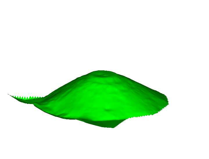
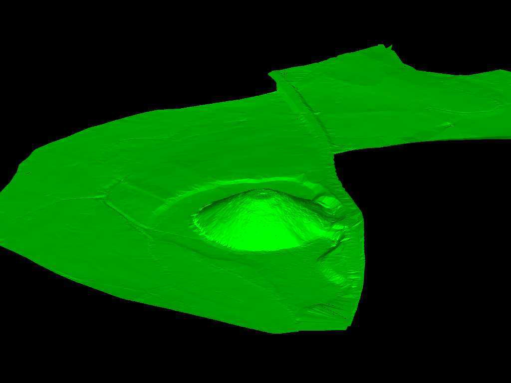
3D Terrain Models (David Field)
2001 news
Radio Carbon Dates.
A piece of deer antler has proved that Silbury Hill
was completed around 4,500 years ago.
The first scientific evidence for the date of one of the most
puzzling of our ancient monuments is one of two antlers found at
the summit of the 130 ft hill.
The fragments are the broken tips of the picks with which the
monument was built, that were thrown into the top of the hill as
the last gaps between the blocks of cut chalk were filled with
rubble.
While the first phase of building at Silbury may be centuries
older, the dating of the antler proves the structure was complete
almost 1,000 years before the last arrangement of the boulders
at Stonehenge.
The dating, by the Oxford University radiocarbon unit, yields a
late Neolithic date of about 2490-2340BC, with 95% certainty of
accuracy.
Although the Roman coins and the scraps of medieval horse
harness also found in the excavation looked more intriguing, it
was the antlers which caused most excitement. They were the
first organic finds from a previously undisturbed part of the
mound.
3D Tomography.
Gloucester based site investigation contractor
Geotechnical Engineering sank the 4 boreholes using one of its in-house
developed Pioneer rigs.The 2.7ft rig had to be
winched up the steep hillside on a trailor, the same method that was
adopted to take the drilling supplies to the summit.
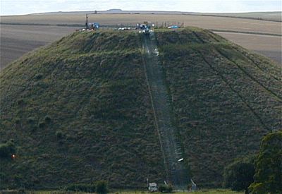
Dynamic sampling was used to obtain 100% core recovery
through the soft, uncompacted chalk down to 30m.
The rig was then switched to rotary drilling to
core down through the chalk bedrock.
Cores were boxed up and taken to a coldstore where
English Heritage is logging them for archaeological information.
The structure of the hill is being being surveyed
using seismic signals released from a source lowered into the
boreholes and picked up with receivers in adjacent
boreholes. This will provide geophysical information about
the core of the hill, which is the main area of
concern.
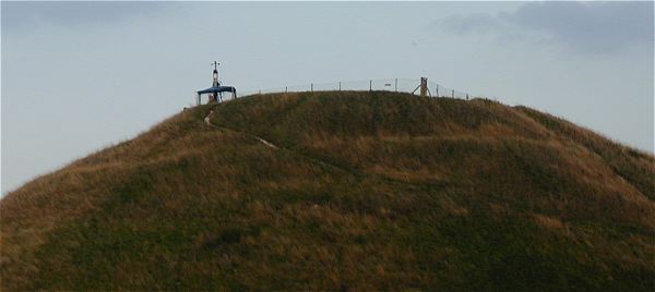
A surface seismic survey will also be carried out,
with geophones placed in the top of the hill and the sources in the
boreholes as before. This provides geophysical
data from the hill core to its surface, allowing a complete model
of the hill to be built up. The software used to
interpret and analyse the seismic data from the survey has been developed
by US company NSA Engineering. it converts the
raw data into 3D images that can be easily understood.
The colour of the images depends on the seismic
velocity of the surveyed rock; cooler colours represent low velocity
seismic waves, ie cavities or low density material,
and warmer colours represent higher velocities, strong, dense material.
The 3D model can be picked up and rotated or sliced
in any direction and different colours or seismic velocities can be removed
from the model to highlight the lowest or highest
velocities.
Investigation work started on the site in August
and was completed by the begining of October.
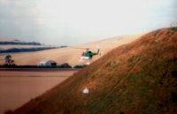
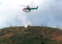
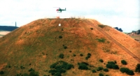
16th August 2001
Work starts on filling the hole.
A helicopter was used to carry tons of chalk
to the top of the hill to stabalise it before 3D scanning starts.
 .
. .
.
LINKS (Open in new browser window)
Current Archaeology
Head Heritage
BBC On-Line news report
Vandals Admit damaging the inside of the hill
Home


 .
. .
.
